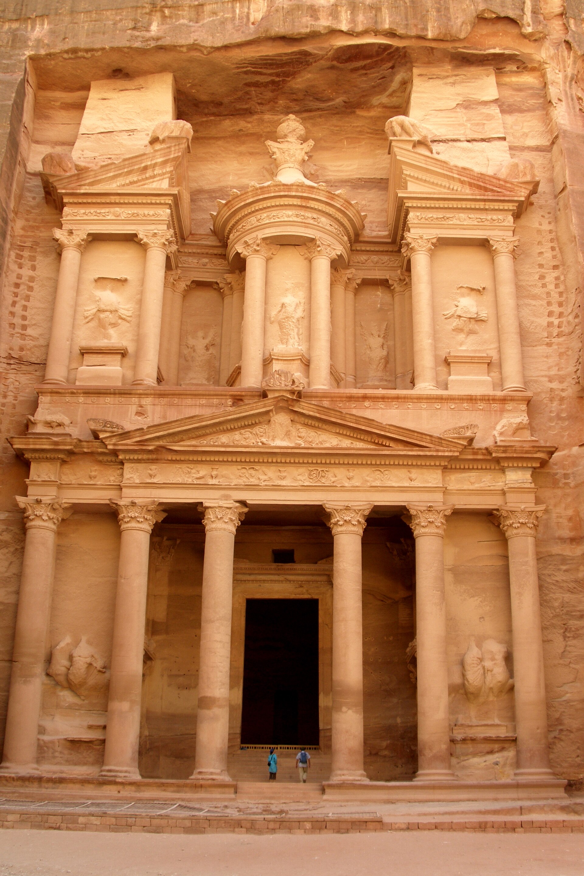
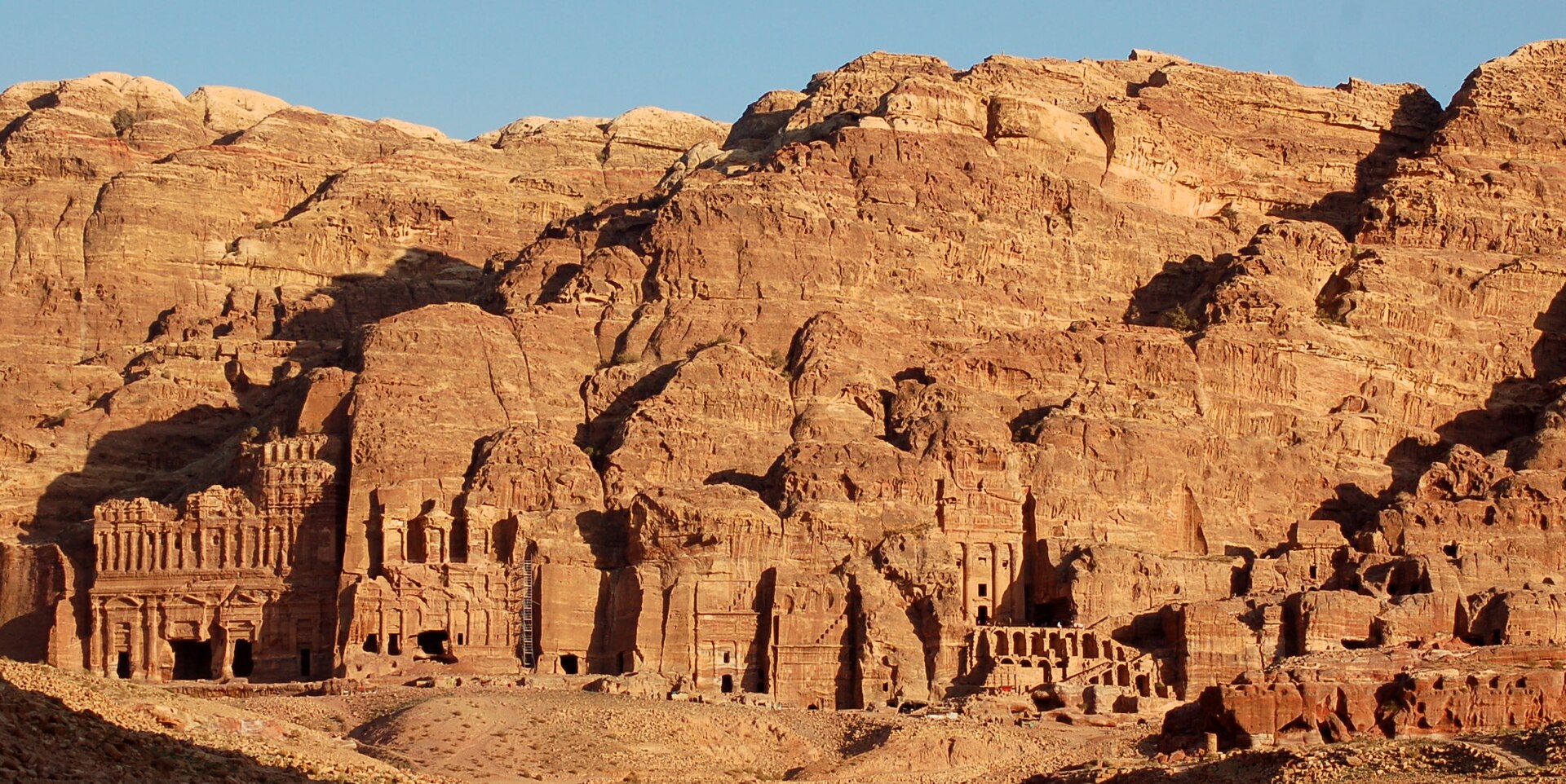
The Nabataeans emerged from nomadic Arab trading tribes of the northern Arabian desert, first recorded in 312 BCE resisting an attack by one of Alexander’s successors at Petra or nearby Sela. Within a few centuries they had built a kingdom whose wealth came entirely from controlling trade: frankincense and myrrh moving north from southern Arabia, spices arriving by sea at their Red Sea port of Leuke Kome, silk and goods passing between Arabia, Egypt, and the Mediterranean. They carved their capital, Petra, directly into the rose-colored sandstone of a narrow desert canyon, engineering a water system sophisticated enough to sustain a major city in an arid gorge. Under Aretas IV (9 BCE-40 CE) the kingdom reached from Hegra in the Hijaz to the Hauran near Damascus, and Petra received its grandest monuments, including the Treasury facade.
The kingdom’s independence ended quietly. When the last king, Rabbel II Soter, died in 106 CE, Rome moved troops in from Syria, Judaea, and Egypt and annexed the territory as the province of Arabia Petraea, with a new capital at Bostra — no battle is recorded. Nabataean identity did not vanish at that moment: the language persisted in spoken use among some populations into the 4th century CE, and Nabataean script gradually morphed into the earliest form of Arabic script over the following centuries. But the political entity was gone, and the economic base went next. By the 4th century, growing Red Sea shipping routes and rival caravan hubs like Palmyra had already been pulling trade away from the overland incense road. A massive earthquake in 363 CE destroyed roughly half of Petra and wrecked its water system, ending what commercial life remained. Dominance built on controlling one road lasts only as long as the road matters.
Worth remembering
- They carved an entire monumental city, Petra, directly into sandstone cliffs, including facades over 40 meters tall, with no comparable engineering elsewhere on the incense route.
- Originally nomadic traders from the Arabian interior, they controlled roughly 2,400 km of the frankincense and myrrh trade from southern Arabia to the Mediterranean, plus the Red Sea port of Leuke Kome.
- Their capital's water-management system — cisterns, channels, and dams cut into rock — let a desert city support a large settled population; the same system's destruction in the 363 CE earthquake helped finish Petra off.
The people
-
Aretas IV Philopatris — Greatest king; peak of territory and building, r. 9 BCE-40 CE
Presided over the kingdom's maximum territorial extent and Petra's major architectural program, including much of the Treasury and Royal Tombs complex.
-
Rabbel II Soter — Last king, r. 70-106 CE
His death in 106 CE was the immediate trigger for Rome's annexation of the kingdom, which was absorbed without significant recorded resistance.
Gallery
Further reading
Sources
- The Nabataeans are first attested in 312 BCE, when Antigonus I's officer Athenaeus attacked them at Petra/Sela without success, an account preserved by Diodorus Siculus from Hieronymus of Cardia's eyewitness report Wikipedia
- The Kingdom of Nabatea was annexed by Rome as the province of Arabia Petraea under Trajan in 106 CE, with troops from Syria, Judaea, and Egypt occupying the kingdom without significant recorded resistance following the death of the last king, Rabbel II Soter Wikipedia
- Rabbel II Soter ruled the Nabataean Kingdom from 70 to 106 CE as its last king; the province of Arabia Petraea was organized with its capital at Bostra Wikipedia
- Under Aretas IV Philopatris (9 BCE-40 CE) the kingdom reached its greatest territorial extent, stretching from Hegra in the south to the Hauran near Damascus in the north, with Petra at the peak of its architectural development Wikipedia
- The Nabataeans controlled the overland incense trade route carrying frankincense and myrrh roughly 2,400 km from southern Arabia to the Mediterranean, as well as the Red Sea port of Leuke Kome Wikipedia
- Nabataean Aramaic continued as a spoken language among some populations into the 4th century CE, and its script evolved into early Arabic script before Arabic fully displaced it by around 650 CE Wikipedia
- Petra's decline as a commercial center predates the 363 CE earthquake: by the 4th century CE, growth in Red Sea shipping and the rise of rival caravan cities such as Palmyra had already drawn trade away from the overland incense route Smithsonian Magazine
- The 363 CE Galilee earthquake destroyed roughly half of Petra's structures and crippled its water-management system, effectively ending the city's commercial life Wikipedia
A graveyard tradition: leave a stone to show you came, and remembered.