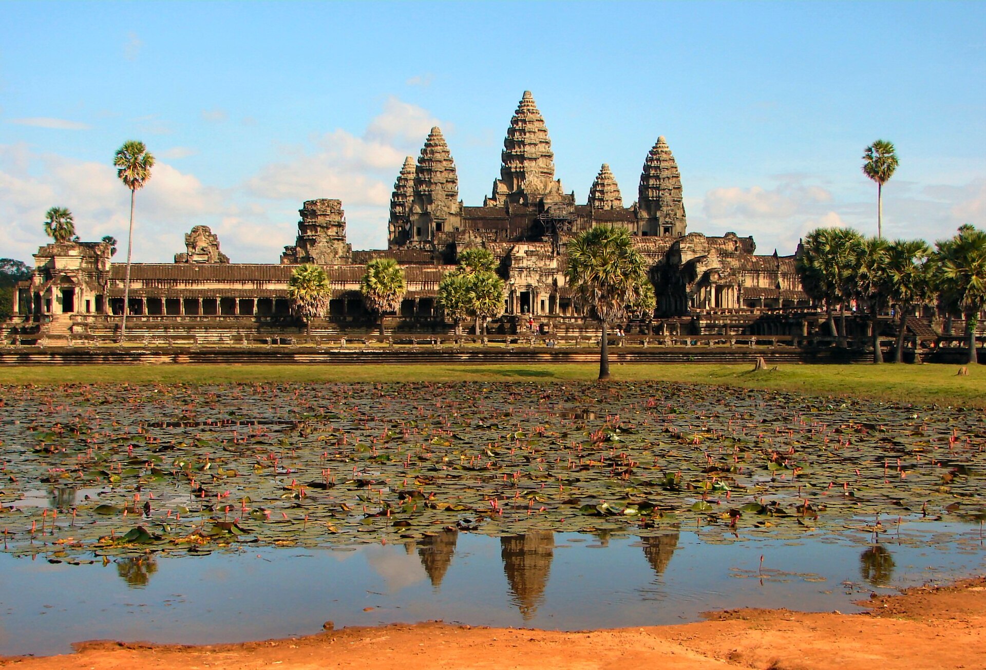
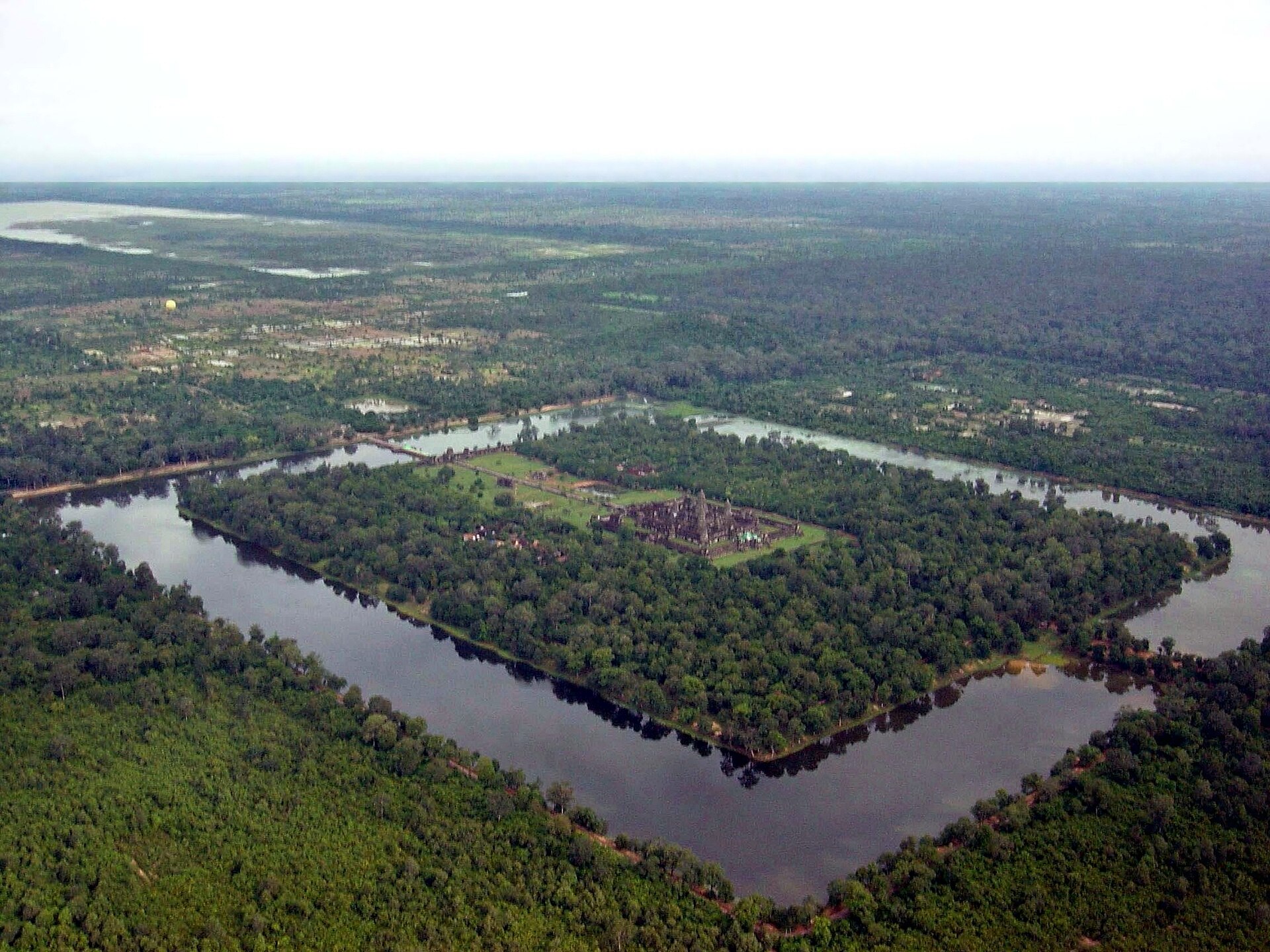
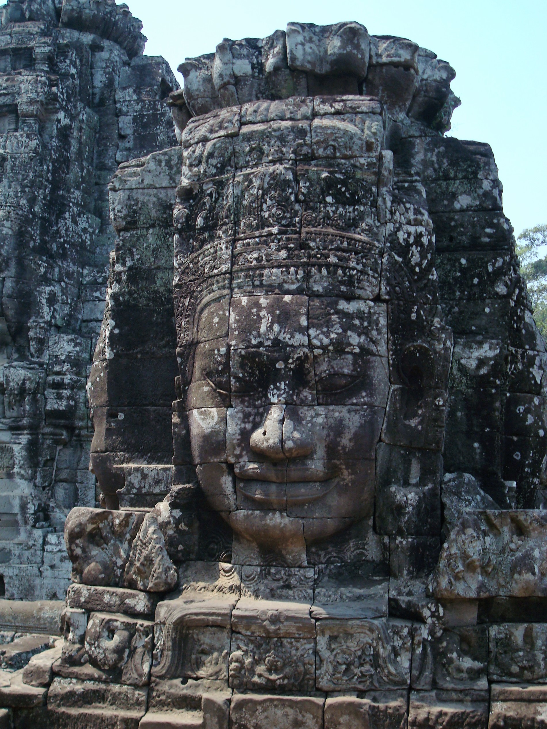
For six centuries the Khmer Empire dominated mainland Southeast Asia from Angkor, a sprawling hydraulic city whose canals, reservoirs (baray), and rice fields supported a population that may have reached three-quarters of a million — the largest pre-industrial urban complex ever mapped. At its heart stood Angkor Wat, the Hindu temple-mountain raised by Suryavarman II in the early 12th century and still the largest religious monument on Earth.
That engineered landscape was its strength and its fault line. Lidar surveys and climate records suggest that in the 14th and 15th centuries a series of extreme monsoon swings — severe droughts punctuated by violent floods — overwhelmed the water network the whole civilization depended on. Weakened, Angkor was sacked by the rising Ayutthaya kingdom and abandoned as a capital around 1431. The empire that mastered water was undone by it.
Worth remembering
- Angkor Wat is the largest religious monument on Earth, and greater Angkor the most extensive pre-industrial city ever mapped — home to perhaps 750,000 people.
- The whole civilization ran on water: an engineered web of canals and vast reservoirs (baray) that turned the monsoon into year-round rice.
Gallery
Watch
Sources
- Khmer Empire founded 802 CE by Jayavarman II Encyclopaedia Britannica
- Angkor among the largest pre-industrial settlements; decline linked to monsoon failure and Ayutthaya's 1431 attack Wikipedia
- Angkor Wat, the world's largest religious monument, was built by Suryavarman II in the early 12th century as a Hindu temple-mountain World History Encyclopedia
- The Khmer Empire's hydraulic city of Angkor was the world's most extensive pre-industrial urban complex, connected by a vast canal and reservoir network World History Encyclopedia
A graveyard tradition: leave a stone to show you came, and remembered.